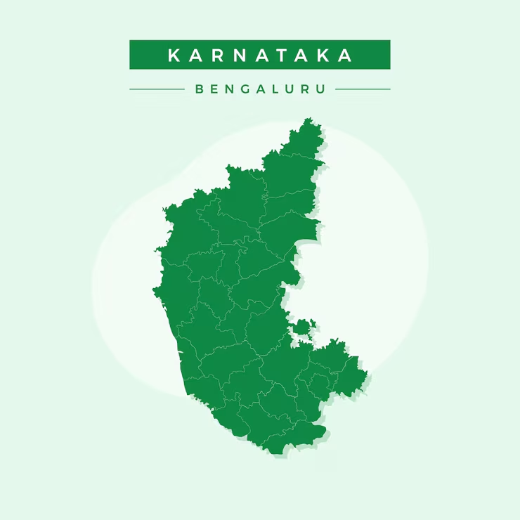
Karnataka is a major state of South India, known for its rich history, cultural diversity, IT hubs, forests, coastline, and heritage cities. Karnataka was officially formed on 1 November 1956 (as Mysore State earlier) and later renamed Karnataka in 1973. The total geographical area of the state is about 191,791 sq km.
Karnataka shares its boundaries with Maharashtra, Goa, Telangana, Andhra Pradesh, Tamil Nadu, and Kerala. For efficient administration and governance, the state is divided into districts.
How Many Districts Are There in Karnataka?
The answer to the most common question—how many districts are there in Karnataka—is:
There are 31 districts in Karnataka (as per the current administrative structure).
These Karnataka districts are grouped under 4 administrative divisions and together include:
270+ towns and cities
29,000+ villages
Each district is administered by a Deputy Commissioner (DC) under the supervision of a Divisional Commissioner.
Karnataka Administrative Divisions
The state is divided into four major divisions, under which all Karnataka districts are grouped:
Bengaluru Division
Belagavi Division
Kalaburagi Division
Mysuru Division
Karnataka Districts List
Below is the complete Karnataka Districts List, along with their headquarters and area.
| No. | District | Headquarters | Area (sq km) |
|---|---|---|---|
| 1 | Dakshina Kannada | Mangaluru | 4,559 |
| 2 | Davanagere | Davanagere | 5,926 |
| 3 | Kodagu | Madikeri | 4,102 |
| 4 | Koppal | Koppal | 5,565 |
| 5 | Kolar | Kolar | 4,012 |
| 6 | Gadag | Gadag-Betageri | 4,651 |
| 7 | Dharwad | Dharwad | 4,265 |
| 8 | Bidar | Bidar | 5,448 |
| 9 | Udupi | Udupi | 3,879 |
| 10 | Uttara Kannada | Karwar | 10,291 |
| 11 | Kalaburagi (Gulbarga) | Kalaburagi | 10,990 |
| 12 | Chamarajanagar | Chamarajanagar | 5,102 |
| 13 | Chikkamagaluru | Chikkamagaluru | 7,201 |
| 14 | Ramanagara | Ramanagara | 3,573 |
| 15 | Chitradurga | Chitradurga | 8,437 |
| 16 | Tumakuru | Tumakuru | 10,598 |
| 17 | Belagavi | Belagavi | 13,415 |
| 18 | Ballari | Ballari | 8,439 |
| 19 | Chikkaballapur | Chikkaballapur | 4,208 |
| 20 | Mandya | Mandya | 4,961 |
| 21 | Yadgir | Yadgir | 5,225 |
| 22 | Mysuru | Mysuru | 6,854 |
| 23 | Shivamogga | Shivamogga | 8,495 |
| 24 | Raichur | Raichur | 6,839 |
| 25 | Hassan | Hassan | 6,814 |
| 26 | Haveri | Haveri | 4,825 |
| 27 | Vijayapura (Bijapur) | Vijayapura | 10,517 |
| 28 | Bagalkot | Bagalkot | 6,583 |
| 29 | Bengaluru Urban | Bengaluru | 2,190 |
| 30 | Bengaluru Rural | Bengaluru | 2,239 |
| 31 | Vijayanagara | Hospet | 6,564 |
Division-wise Karnataka Districts
Bengaluru Division
Bengaluru Urban
Bengaluru Rural
Ramanagara
Kolar
Chikkaballapur
Tumakuru
Belagavi Division
Belagavi
Bagalkot
Vijayapura
Dharwad
Gadag
Haveri
Uttara Kannada
Kalaburagi Division
Kalaburagi
Bidar
Yadgir
Raichur
Koppal
Ballari
Vijayanagara
Mysuru Division
Mysuru
Mandya
Hassan
Chamarajanagar
Kodagu
Chikkamagaluru
Shivamogga
Davanagere
Dakshina Kannada
Udupi
Important Facts About Karnataka Districts
Largest district by area: Belagavi
Smallest district by area: Bengaluru Urban
Newest district: Vijayanagara
Most urbanized district: Bengaluru Urban
Coastal districts: Dakshina Kannada, Udupi, Uttara Kannada
Importance of Karnataka Districts
The division into districts helps Karnataka in:
Efficient administration
Local governance and development
Law and order management
Planning education, health, and infrastructure
Each district has unique cultural, geographical, and economic significance.
FAQs:
Q. How many districts are there in Karnataka?
A. There are 31 districts in Karnataka.
Q. Which is the largest district in Karnataka by area?
A. Belagavi district is the largest by area.
Q. Which is the smallest district in Karnataka?
A. Bengaluru Urban is the smallest district by area.
Q. How many divisions are there in Karnataka?
A. Karnataka has 4 administrative divisions.
Q. What is the capital district of Karnataka?
A. Bengaluru Urban district contains the state capital, Bengaluru.
Q. Which is the newest district in Karnataka?
A. Vijayanagara district is the newest district.
Conclusion:
The Karnataka Districts List helps us understand the administrative structure of one of India’s most important states. With 31 districts divided into 4 divisions, Karnataka ensures smooth governance across urban, rural, coastal, and hilly regions. From Bengaluru’s IT dominance to Kodagu’s natural beauty, each district contributes uniquely to the state’s identity.


